The hike to Mount Zenone is one of the most scenic in the Alto Garda area, and it takes place along the second Great War frontline.
The itinerary starts near Polsone, a town located at the intersection of the road heading to S. Michele, where you can safely leave your car. From there, follow the path number 168, an ancient military road that climbs uphill gently, and takes you to the Passo della Coca, after about an hour walk and 300 meters in altitude difference.
Continue along path 163, also an old military road - the first part is surrounded by woods, then it follows the rocky walls of Mughera on the right, while on the left, the terrain slopes very steeply with some exposed stretches.
Always heading uphill, you will pass a series of tunnels, not very long, where stretches of rock overlook the path.
Once you have passed the wood, you can admire the first views of Lake Garda, the mountains of Tignale and Mount Baldo.
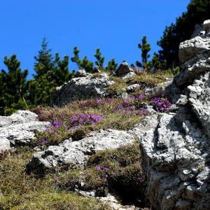
Continue along path 168, this time cutting through wide meadows, surrounded by beautiful flowers, leaving behind a small landslide until you reach the ridge path where you see a fork. Once you get there, continue on the path going up the ridge, between large beech trees, with the valley of San Michele on the left and the Bondo valley and on the right.
Now, the destination of your hike is in sight - the summit of Mount Zenone, located at 1424 meters, only a short way away. Hiking time to the summit is about 2 hours and 20 minutes.
The view that can be admired from the top is remarkable. You can see the Veronese shore and Malcesine, Mount Baldo and Mount Altissimo, while below you can see the villages of Vesio, Prabione, Voltino, and Pieve. On top of that you can also see the peaks of the Garda mountains, from Mount Spino and Pizzoccolo up to Mount Caplone (the highest of the whole group), and the Cima Tombea.
To return to the start, continue for a while along the ridge until you reach a large beech tree. From there, take the path number 169 that descends steeply, always surrounded by breathtaking views, until you reach 168, the military road you followed on the way up, until the starting point of the hike.


